
Family Tree Live!
I’m very excited to part of this upcoming exhibition!
Fantastic Mr Foxes v. Tipping and Faulkoner
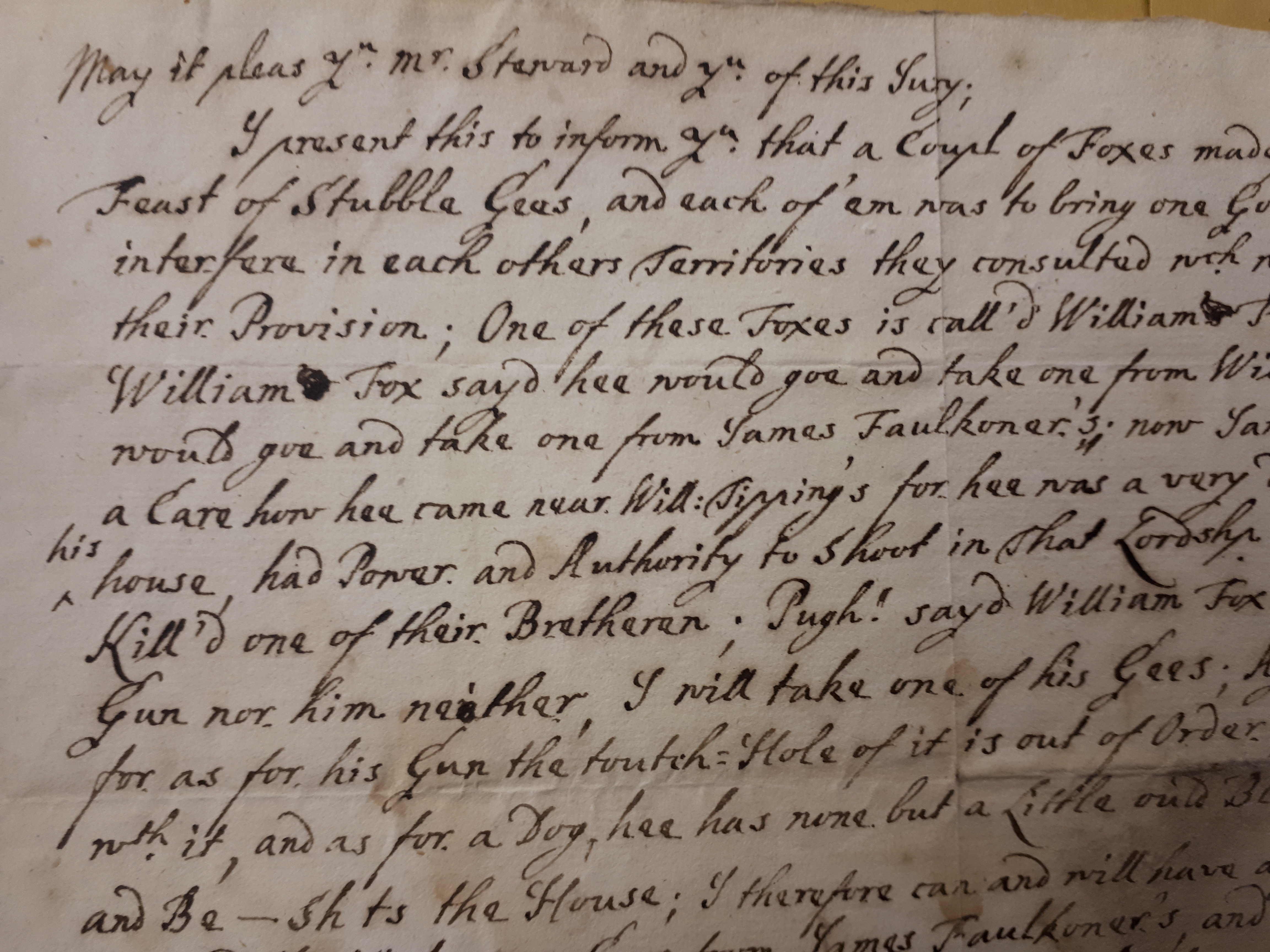
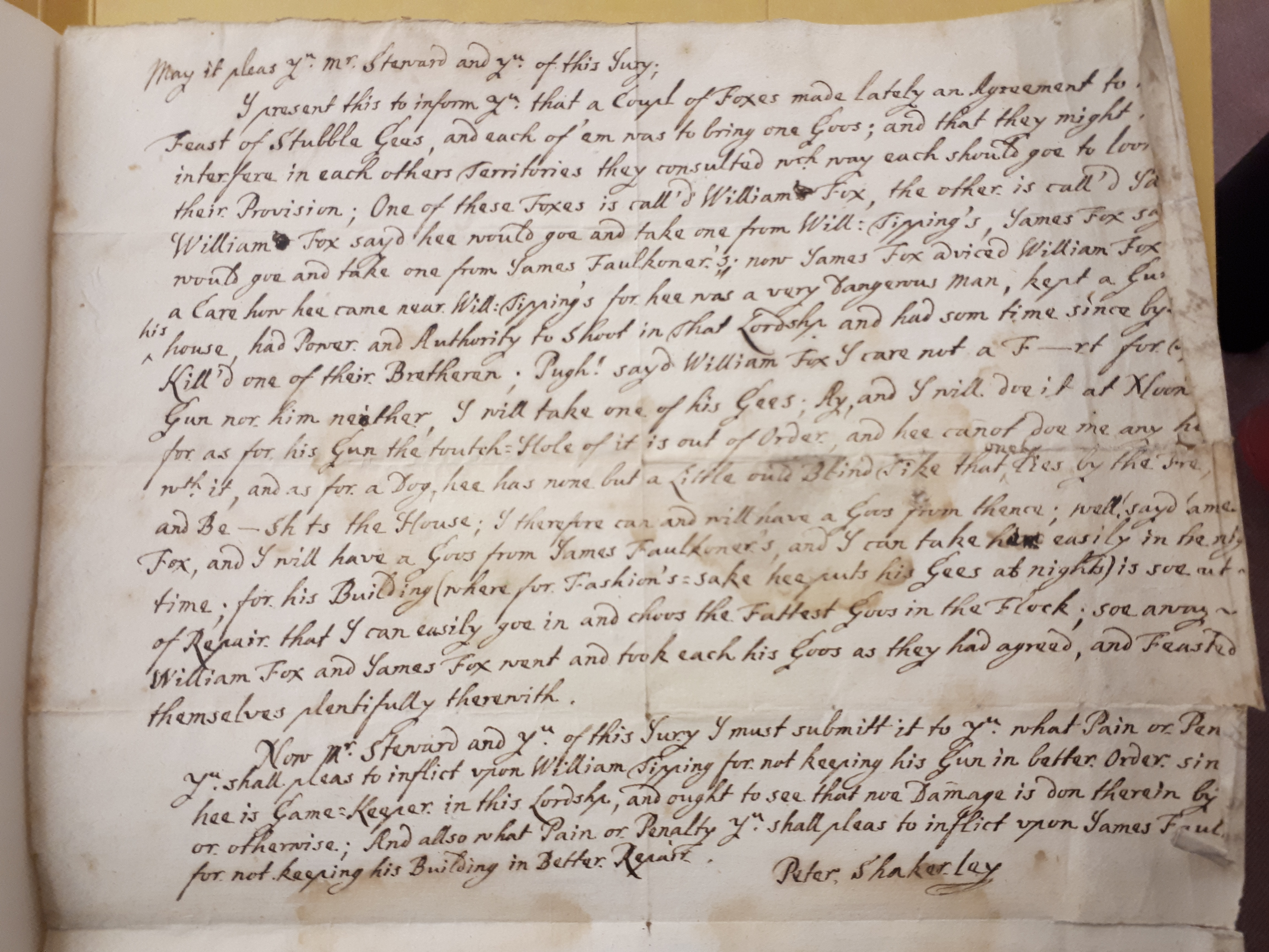
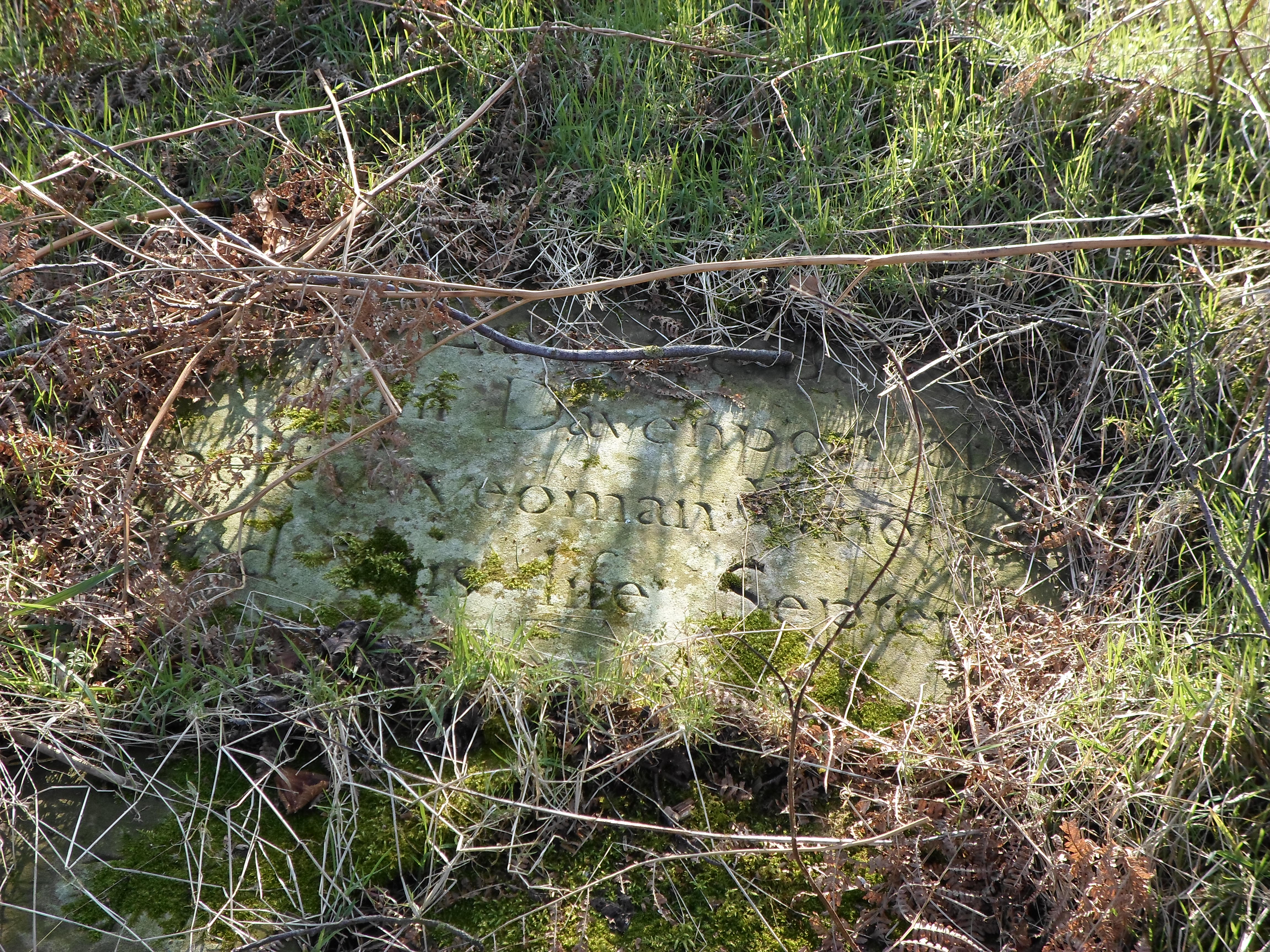
Another trip to Cheshire Record Office, this time for research into Cheshire Gamekeepers,has yielded one of my favourite document finds yet! In the catalogue, it is entitled ‘Mock Manorial Presentment of William Tipping’ and is thought to date from around 1715. It is signed ‘Peter Shakerley’. It details a poaching story, with some real life characters, with a little moral tale thrown in, but who comes out on top? Read on to find out!
“May it pleas you Mr Steward and yr of this Jury,
I present this to inform yr that a couple of Foxes made lately an Agreement to have a feast of Stubble Gees, and each of ’em was to bring one goos; that they might not interfere in each others territories they consulted which way each should goe to look for their provision; one of the Foxes is call’d William Fox, the other is call’d James Fox.
William Fox say’d hee would goe and take one from Will Tipping’s; James Fox say’d he would goe and take one from James Faulknor’s. Now James Fox adviced William Fox to have a care how he came near Will Tipping’s for hee was a very dangerous man, kept a gunn in his home, had power and authority to shoot in that Lordship and had sum time since by shooting, killed one of their Bretheren. Pugh! say’d William Fox, I care not a F___t for Tipping’s gun nor him neither, I will take one of his gees; Ay, and I will due it at noon Day, for as for his Gun, the toutch hole of it is out of Order and he cannot due me any hurt with it, and as for a Dog, hee has none but a little ‘ould Blind Tike that only lies by the fire, and B_shits the house, I therefore can and will have a goos from thence.
Well, say’d James Fox, and I will have a Goose from James Faulkoners, and I can take easily in the night time for his building (where for Fashions sake he puts his geese at nights) is so out of repair that I can easily goe in and choose the fattest goos in the Flock, soe away William Fox and James Fox went and took each his goos as they had agreed and feasted themselves plentifully therewith..” (cont’d below)
Courtesy of Cheshire Archives and Local Studies
The account continues, inviting the Jury to come to their own conclusions:
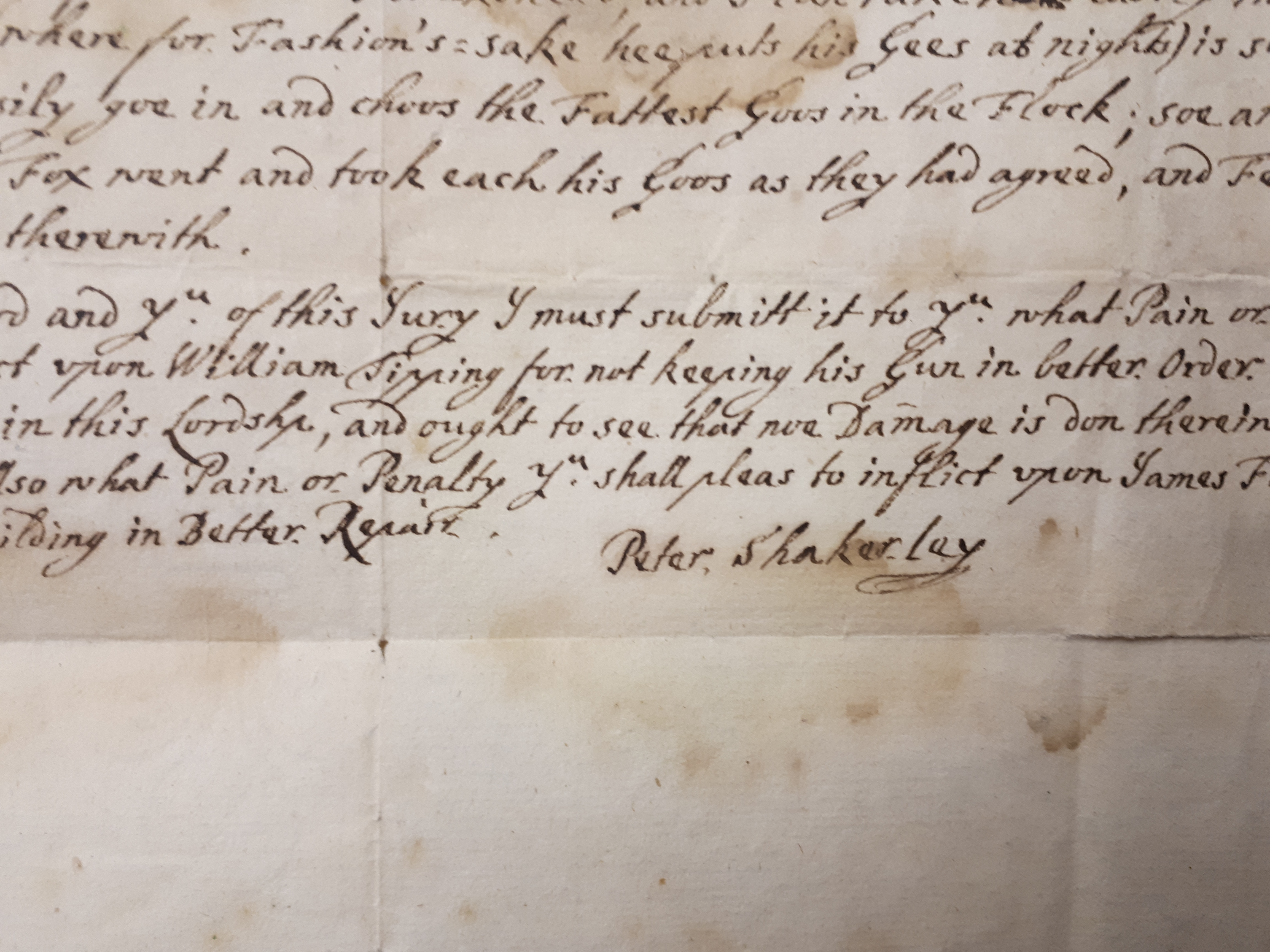
“Now Mr Steward and yr of this Jury, I must submit it to yr, what pain or Penalty you shall please to inflict upon William Tipping for not keeping his gun in better order since he is Gamekeeper in this Lordship and ought to see that noe Damage is don therin by Foxes or otherwise and also what pain or Penalty you shall pleas’ to inflict upon James Faulkoner for not keeping his building in Better Repair.”
Peter Shakerley
Courtesy of Cheshire Archives and Local Studies
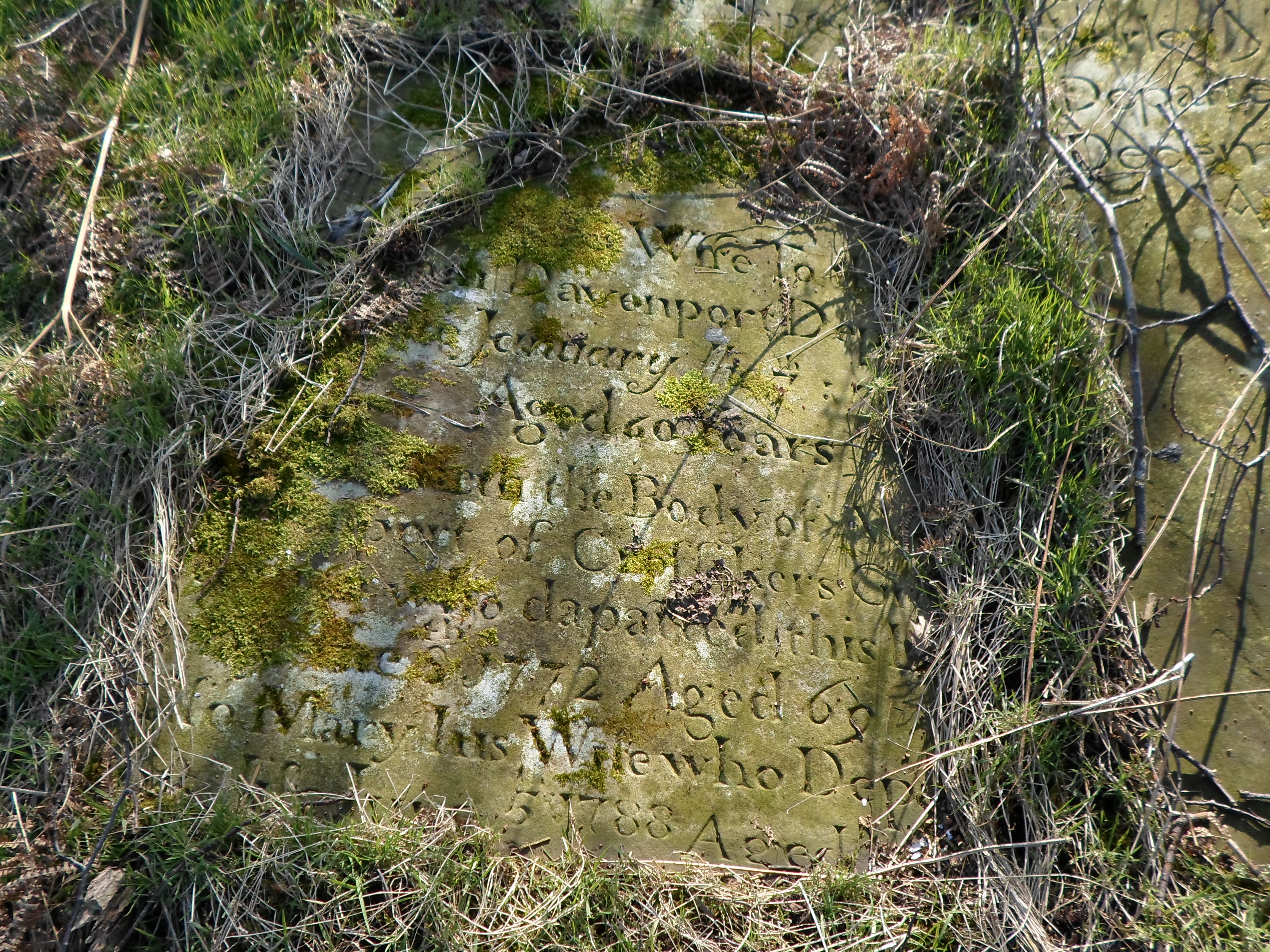
The catalogue entry also notes that William Tipping was indeed a real Gamekeeper, in the Manor of Somerford. Peter Shakerley (1655-1726) held the manor of Hulme and later Somerford, and had the Georgian mansion of Somerford Park built around 1720.
It is difficult to imagine that Shakerley would be the true author of this letter, it is more likely to be someone poking fun. We will probably never know the true writer, but who ever did write it, perhaps an unchallenged poacher on Shakerley’s lands, or a neighbouring Lord, has left a fascinating and witty tale behind, a true Fantastic Mr Fox of the eighteenth century!
Courtesy of Cheshire Archives and Local Studies
Kermincham and it’s Deer Park
The hamlet of Kermincham lies in the parish of Swettenham, about 5 miles north west of Congleton. The parish consists of several farms with geographic names, e.g Brook Farm, Ashtree Farm and some higher status dwellings. Kermincham Hall, Rowley Hall, and Kermincham House (formerly Lodge). The accompanying farmland all surround another farmstead named Old Hall Farm which may be a much older site than the others.
The township of Kermincham in Swettenham
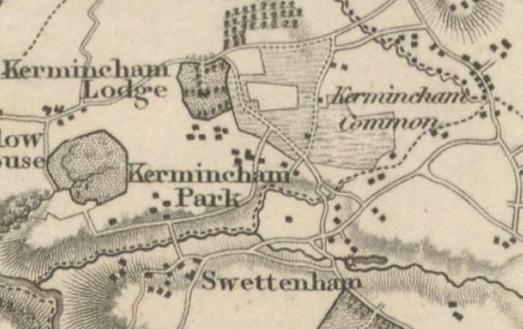
Christopher Greenwood’s Map of 1819
Kermincham Lodge has a very defined circular boundary on Greenwood’s Map. To the east of here, lies Kermincham Common, an area of heathland, which can still be evidenced in the names Heath House and Lower Heath Farm. On the 1839 Tithe Map there are large areas of this land which have not been enclosed.
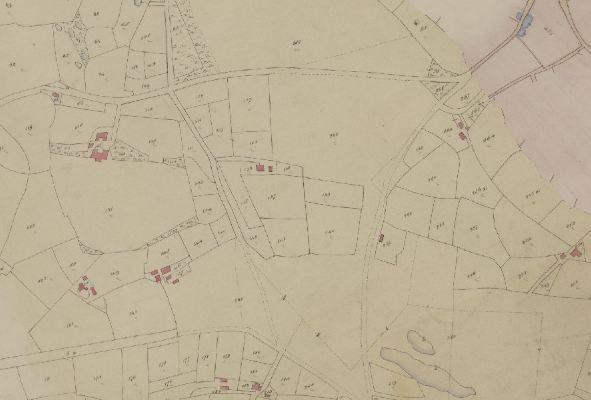
Tithe Map dated 1839
To the north of Forty Acre Lane lies a plot named Large Heath Inclosure, an area cleared out of the existing woodland which still remains on two sides.
What we now know as Long Lane traversed southwards with a few enclosed fields either side, then out into open heathland before ending up at Long House Farm.
By 1875 however, Enclosure was complete, with the lane flanked with neat rectangular fields leading down to the newly realigned Congleton Road.
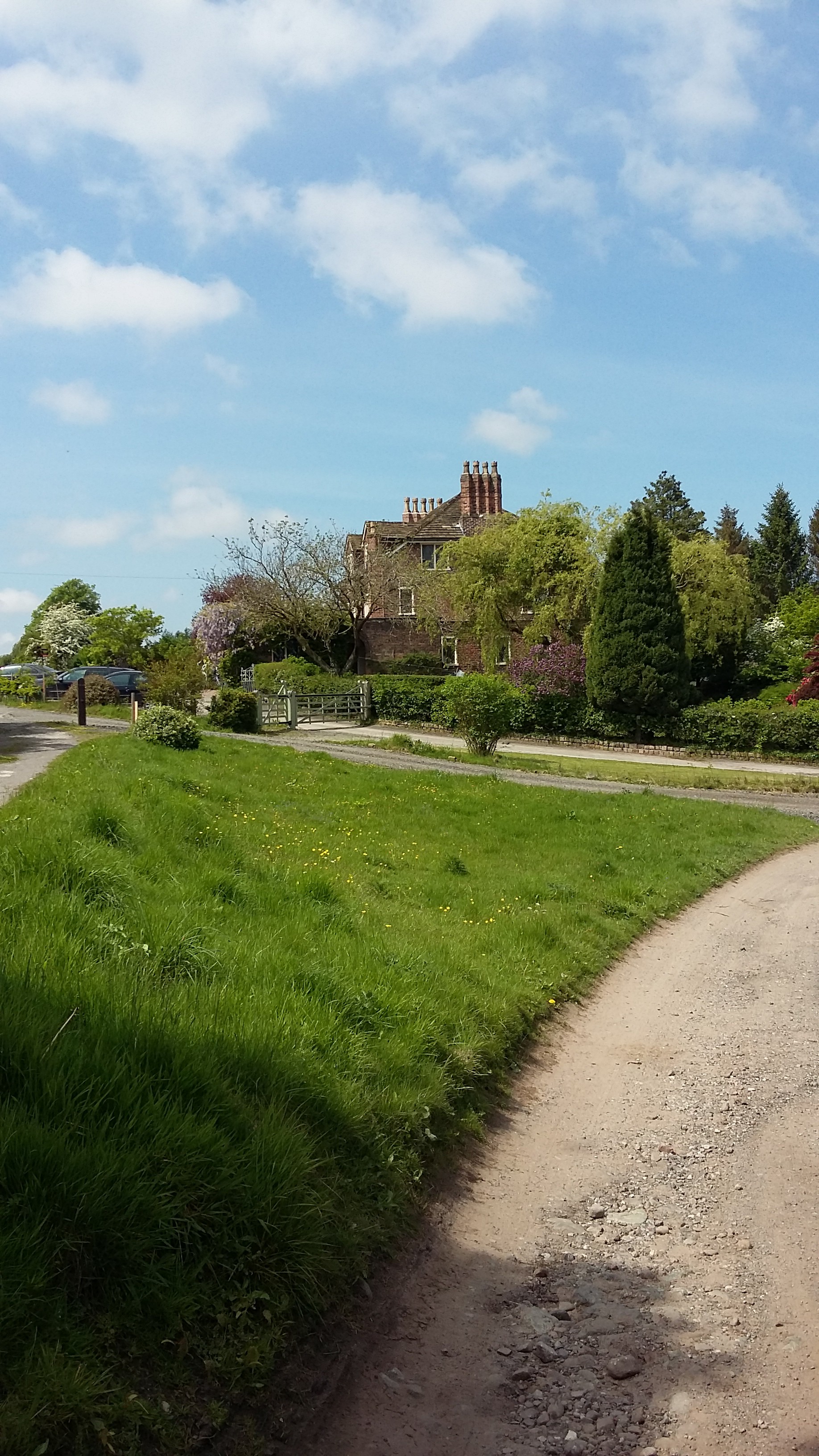
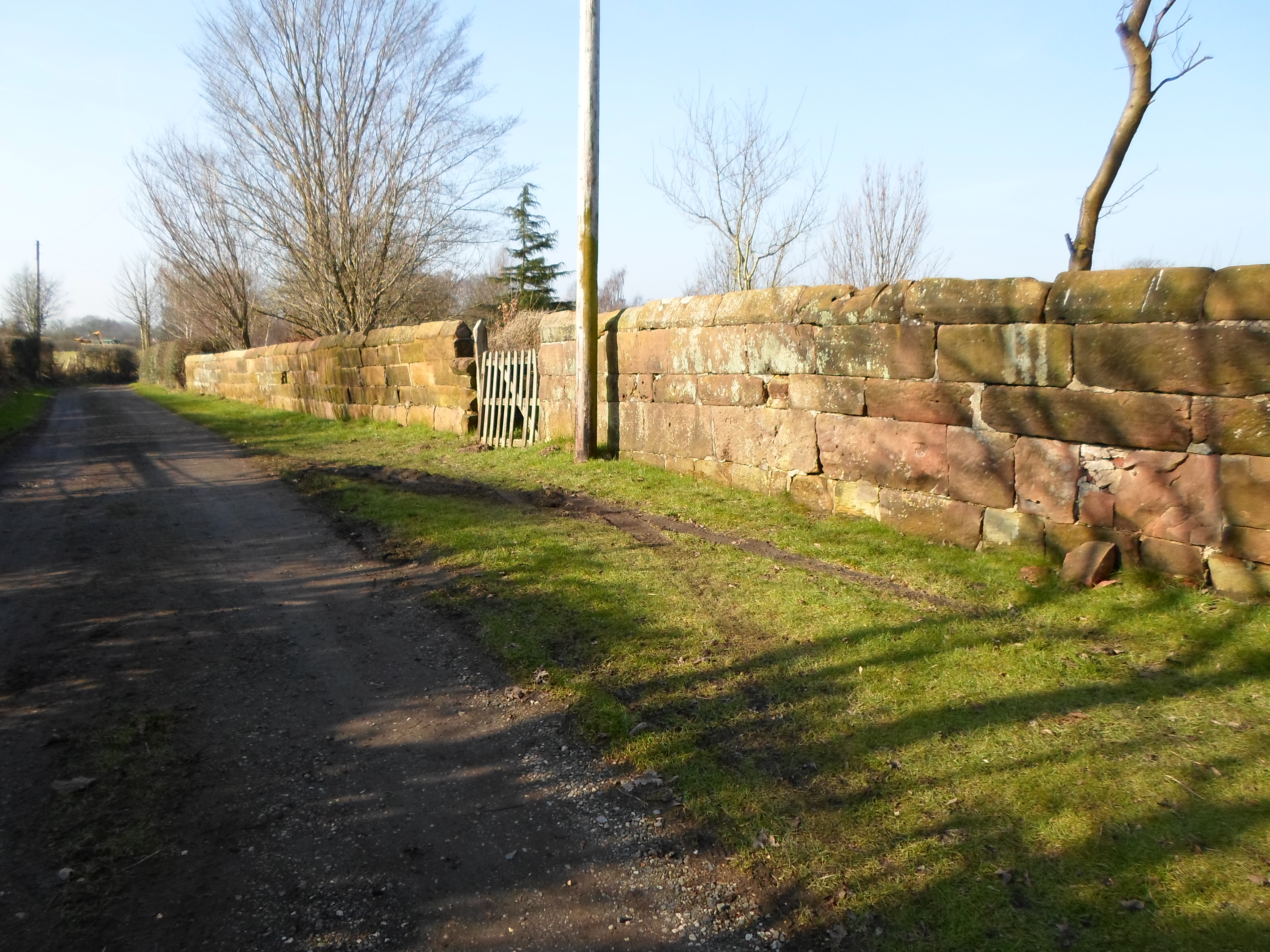
Towards the west of the settlement lies Kermincham Hall, which again on Greenwood’s map is shown as an almost circular enclosure, called Kermincham Park. This residence was once part of the Mainwaring Estate and dates from the mid 19th century, built on the site of an earlier house.
The original house which was built in 1718, lay in a large D-shaped deer park, of approximately 52 acres, and was approached by a long driveway from Kermincham Heath, which now survives as a footpath from the driveway of Dell Farm on Congleton Road.
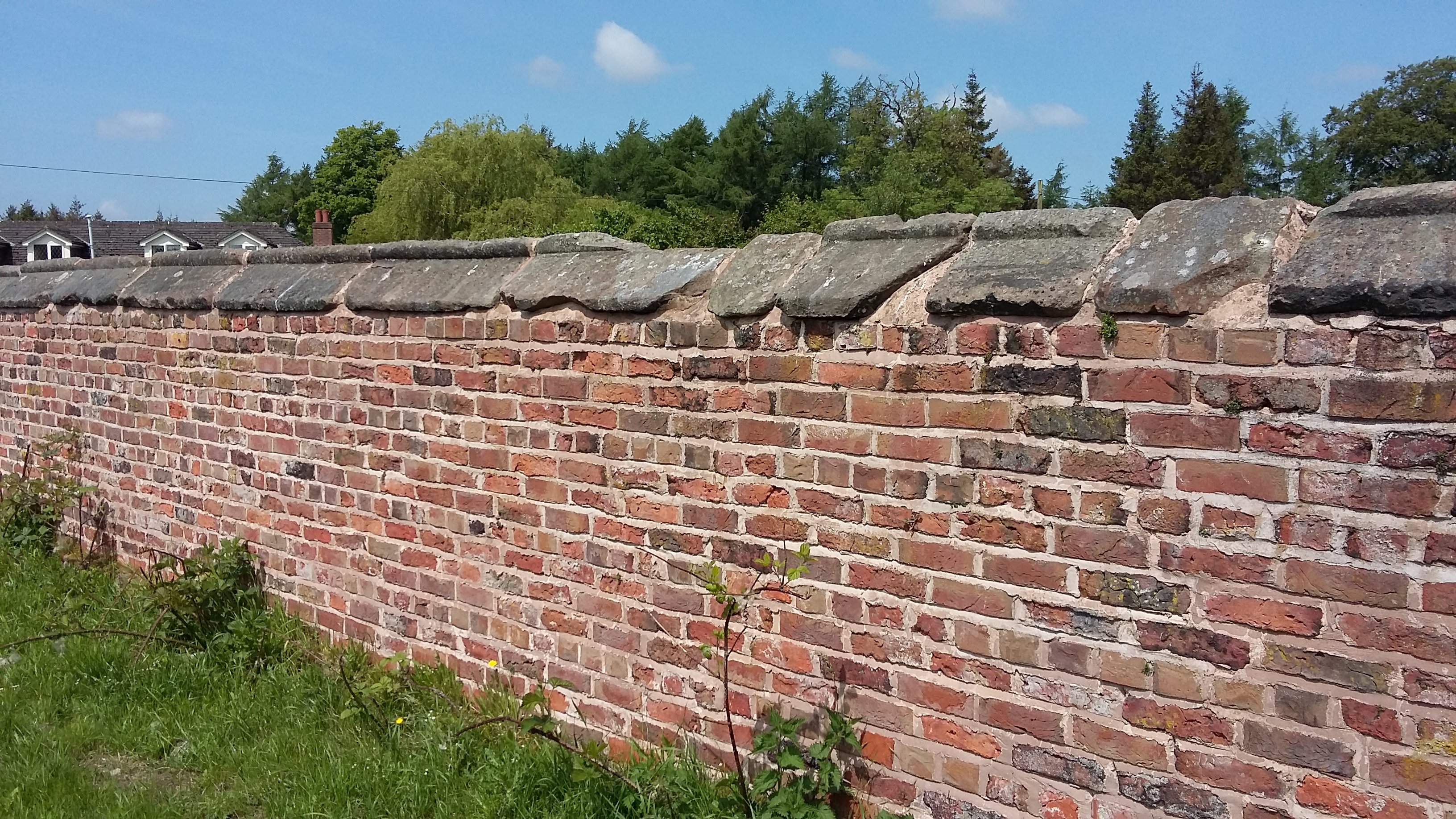
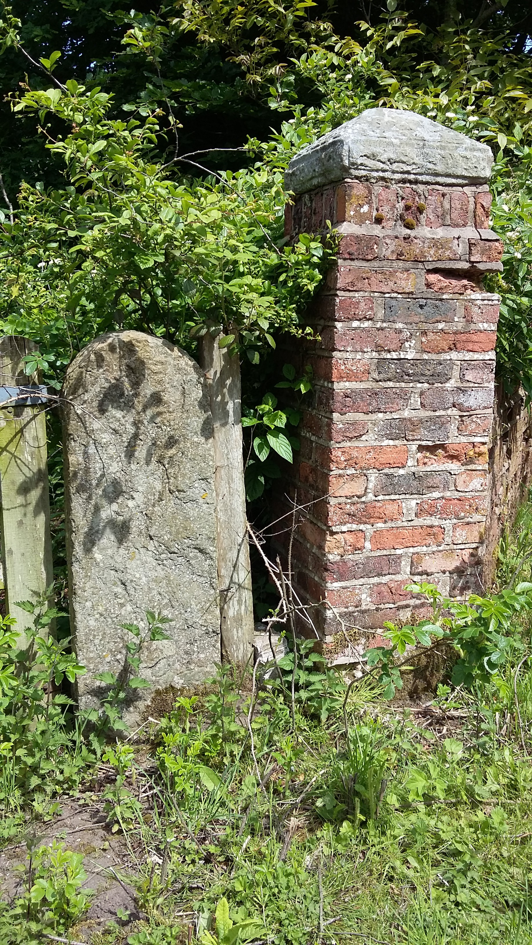
Most of the perimeter brick wall still exists, and would probably been built with locally made bricks; one field near Forty Acre Lane which adjoins the park boundary is marked as Brick Kiln Field on the Tithe Map.
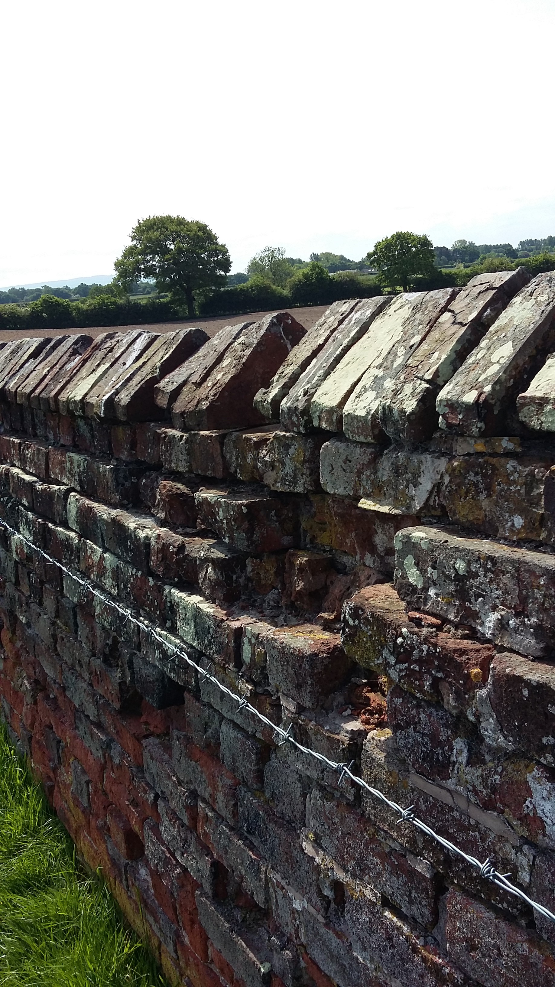
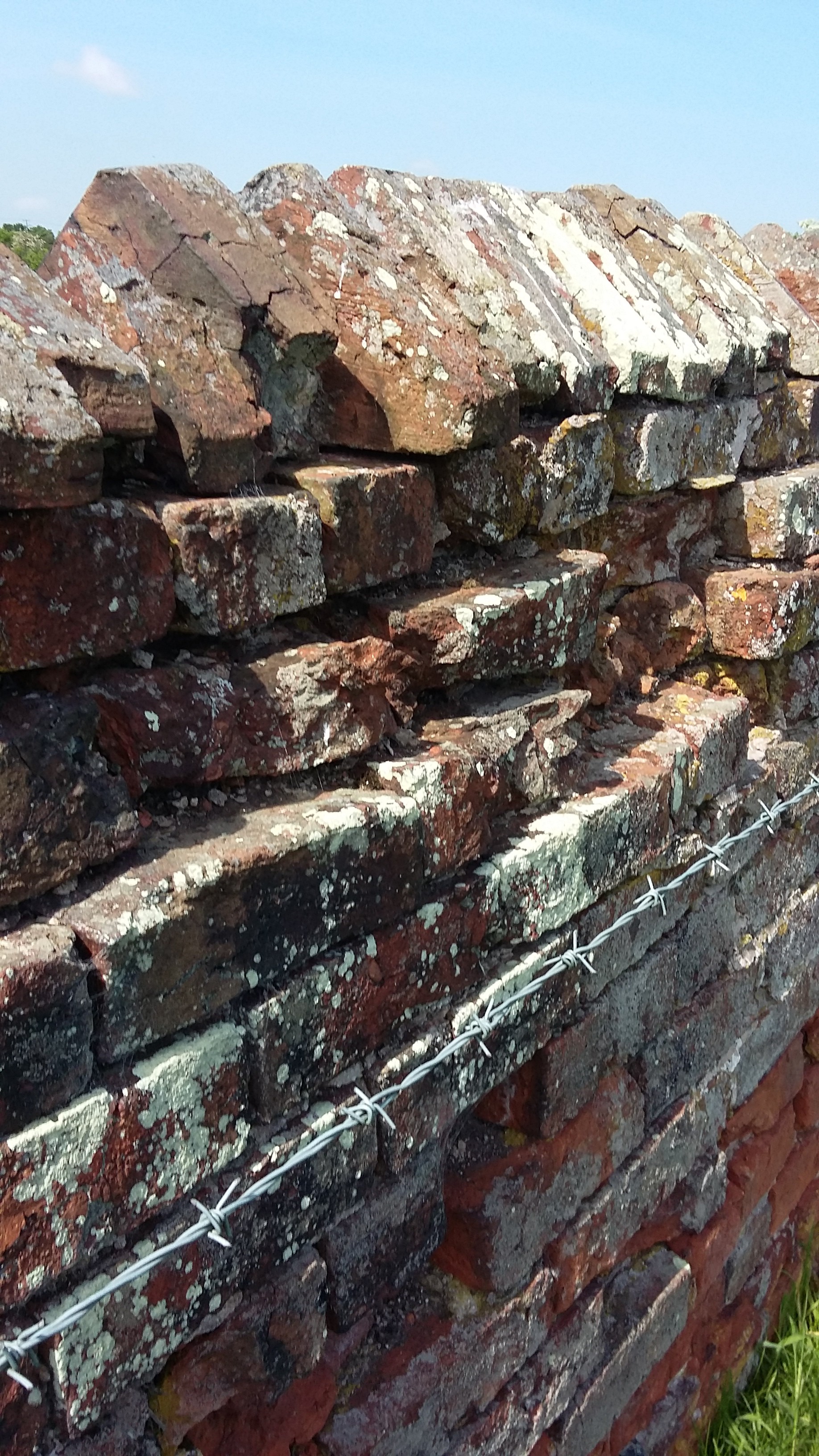
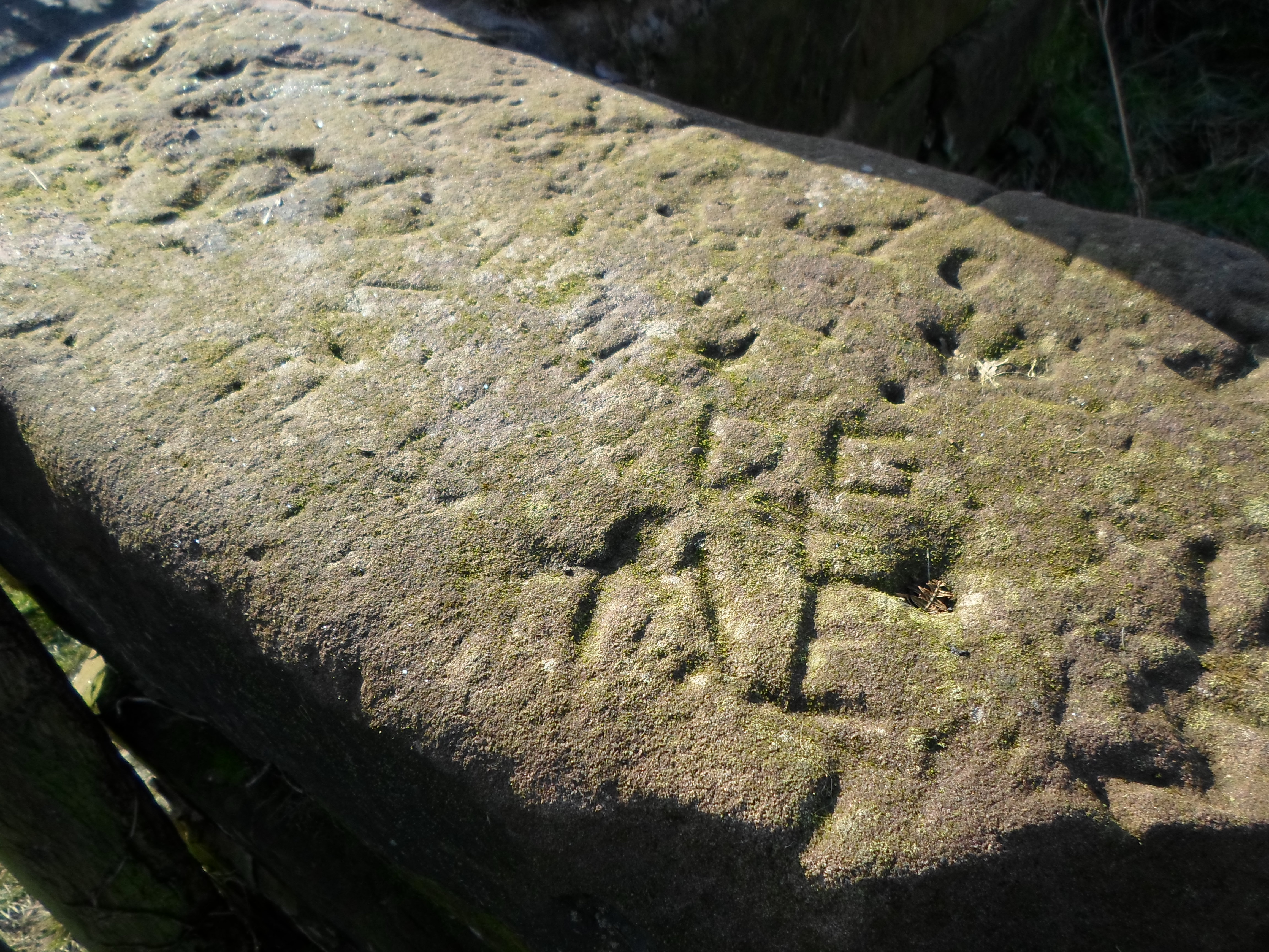
In most places, the wall is four bricks deep, allowing for cross bricks for added strength. It stands approx 1.30m high, with triangular coping bricks, rough hewn yet consistent in size, showing marks of workmanship, with some areas of the main wall English Bond, and others Flemish Bond.
Where coping bricks have either crumbled away or been robbed out, repairs have been carried out over the years, leaving a narrower top to the wall.
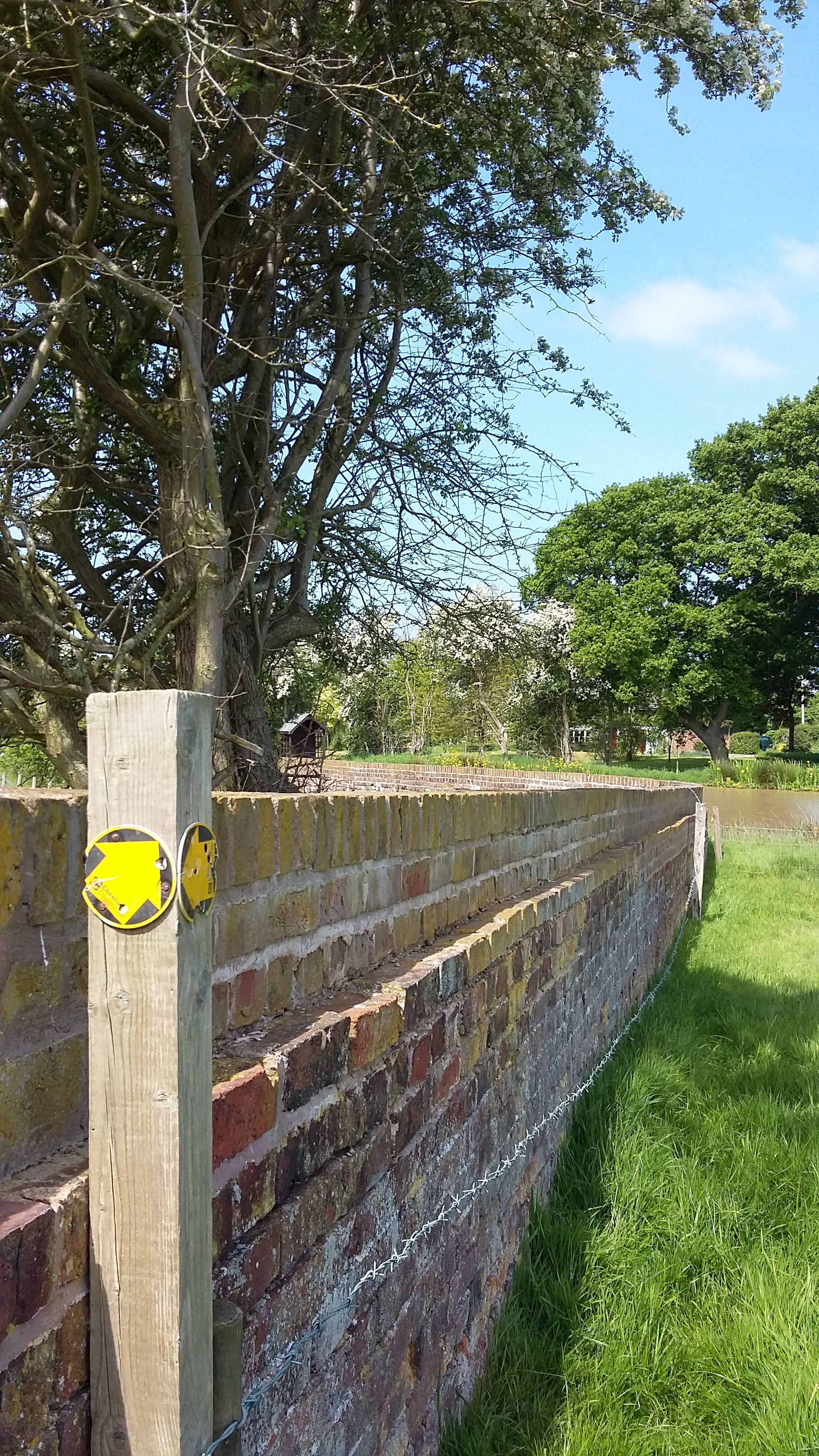
As the wall nears Kermincham Hall, the coping bricks change to coping stones, perhaps a grander facade to have on the wall that forms part of the former driveway.
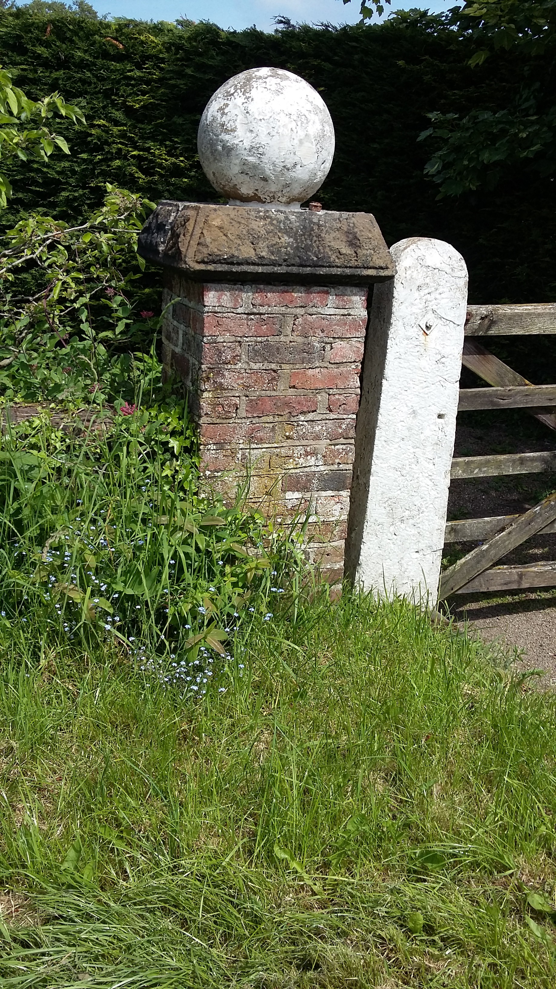
As the driveway approaches the house it pass alongside Deerpark Farm and there is more evidence of the perimeter walls and gateways into the former parkland.
The wall then bends round to the right, briefly following the new entrance road to the Hall, before veering sharply north east to complete the boundary.
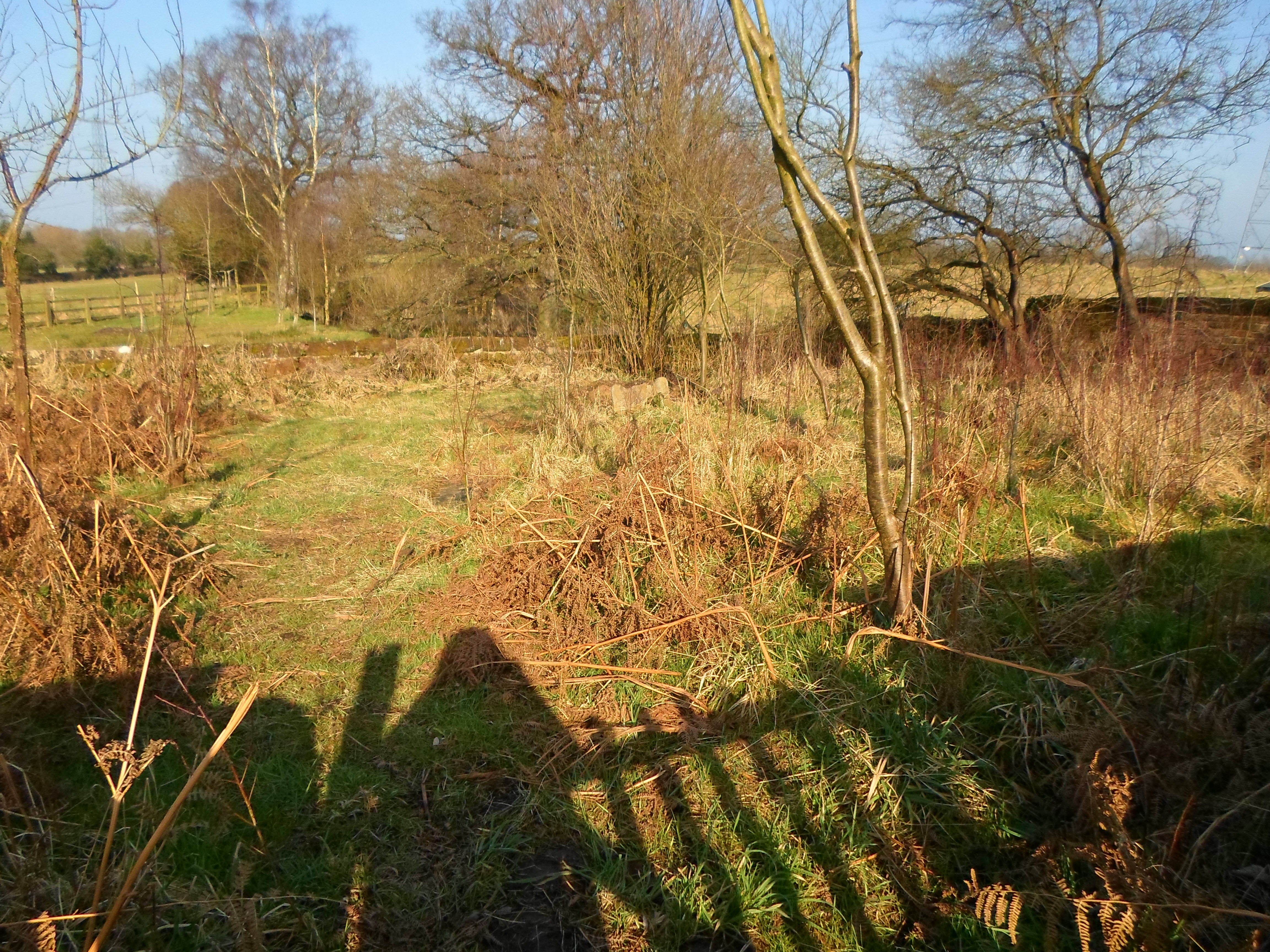
These walls are a remarkable survival of this parkland, of which little written record survives, but remain a striking and beautiful feature of this aspect of manorial life.
Origins and Significance of some Macclesfield Street Names
At first glance, any modern map of Macclesfield shows a jumble of streets, roads, and lanes jostling for position. Looking closer at individual street names reveals insights into their purpose, origin and age.
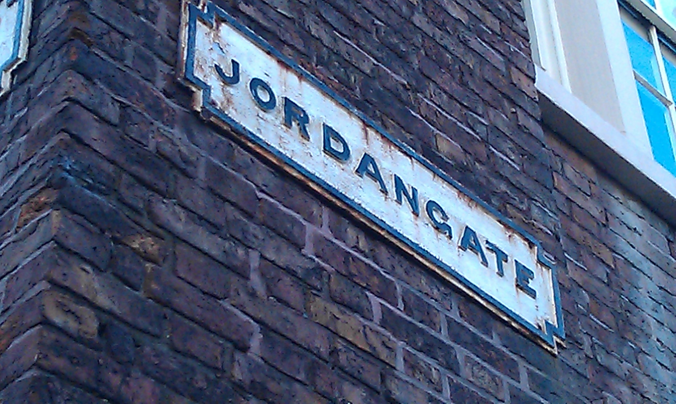
Some street names have been around from the medieval period and still remain today, for example, Jordangate. This can be found in records from the fourteenth century but may have been used as far back as the tenth century. Its importance lies in showing how important the river has always been to the settlement at Macclesfield, as the River Bollin was once called the River Jordan.
Chestergate and King Edward Street also form part of the medieval town plan of Macclesfield
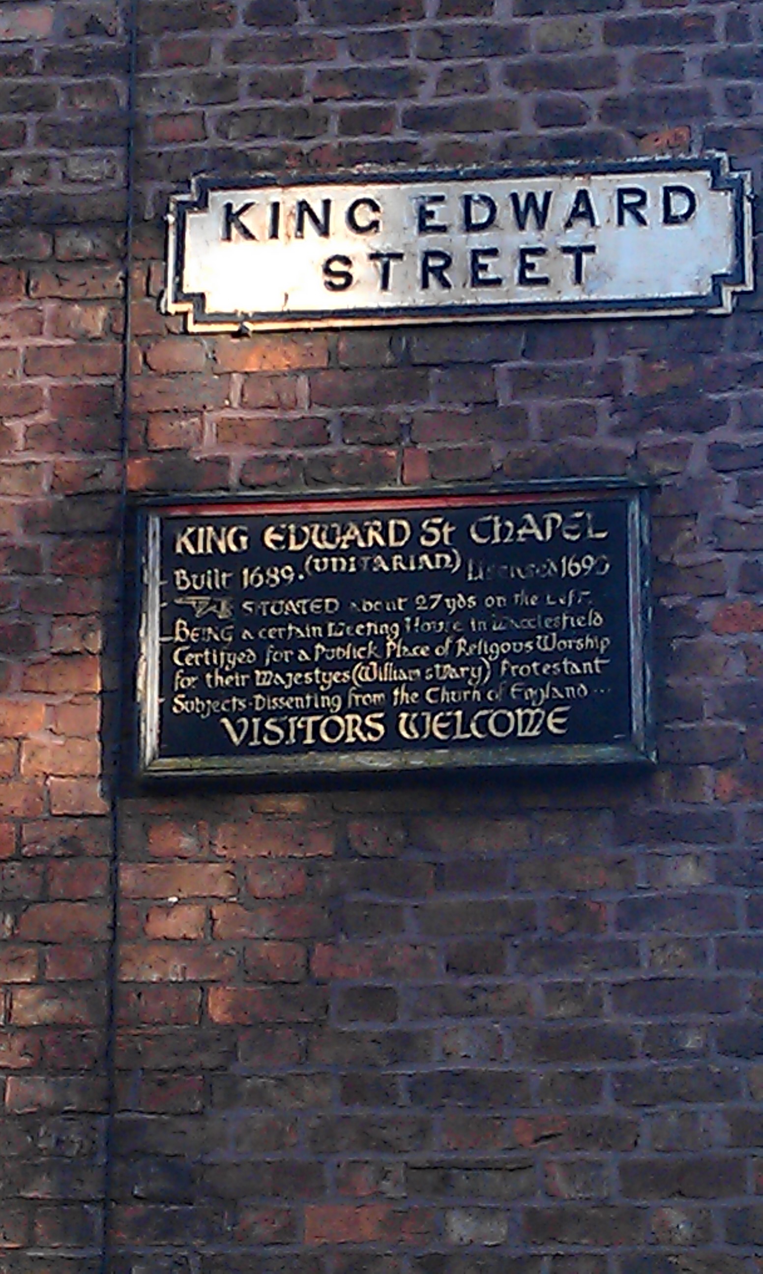
King Edward Street was originally called Back Lane or Back Street but in the seventeenth century took its name from the second oldest place of worship in the town, the King Edward Street Chapel. Built in 1690, it provided a place of safety for thousands of religious dissenters, and today continues to house the Unitarians.
Other street names point to the towns esteemed industrial heritage, none more so than Roe Street. This was named after Charles Roe (1715 – 1781), a prominent local industrialist. He erected the first mill in the town to be use for throwing silk which eventually went on to help establish the great legacy of local silk weaving.
Sadly, yet perhaps, inevitably, some streets have now completely disappeared under modern developments. Of the streets cleared to make way for the Duke Street Carpark, surely it is the name’s of now forgotten Cotton Street and Silk Street which can go some way to summing up the the town’s industrial roots.
Similarly the Grosvenor Shopping Centre and Churchill Way now cover the once thriving Stanley Street (previously Dog Lane), and Derby Street, so named as a clear nod to the Stanley dynasty, Earls of Derby, one of whom Edward Stanley, was Henry VIII’s Steward in the Borough, and whose influence on the town would have been immensely powerful.
Other throughfares have taken on new names; Brunswick Street, was once Goose Lane, from the fact that townsfolk used to drive their ducks and geese down the steep incline to the river below.
Part of Churchside was once known as Le Dede Street, enough to put off anyone taking a shortcut at dusk!

A personal favourite though, must be, Bottefischellarder Lane, thought to be the short street which runs past the Castle Pub, now known simply as Church Street, but whose beginnings can really only be guessed at!
One of the most expressive names that does still exist is Cuckstoolpit Hill. At the bottom of the hill was a pool, over which sat a stool or chair fastened to the end of a long pole. Gossips or nagging women would face a ducking in the water as punishment!
Looking at these has however made me wonder about the process of naming new streets nowadays; some new housing estates boast impossibly idyllic appellations, normally based on aspects of the natural world, influential figures in history or religious edifices, no doubt to encourage potential buyers to part with their cash. The A-Z of Cheshire alone offers no less than 82 instances of Meadowside, The Meadows, Meadow Brow or other variations on this theme, hardly original.
Unsurprisingly, pearls such as Deadman’s Lane, Bottoms Lane, Weedon Avenue or Travers Entry seem to be woefully underused. These will however, live on in memory perhaps because of their uniqueness, rather than in spite of it.
Sources: Streets and Houses of Old Macclesfield by John Earles (1915)
A History of Macclesfield by C.Stella Davies (1961)
Parish Boundaries
Boundaries of parishes have been important for generations; they dictated which church a person would be baptised, married or buried in and where they paid tithes and other taxes. The current civil parish boundaries that we are familiar with on Ordnance Survey maps often follow the same routes as former ecclesiastical ones, with the new unit of administration being defined in terms of the previous one. This can be seen even recently, with the creation of the new Unitary Authorities of Cheshire East and Cheshire West and Chester.
As a result this network of boundaries often form an ancient and lasting pattern within the landscape.
Many of these boundaries follow natural features in the landscape, such as rivers, streams, trees or brows of hills. On open land or woodland, the inhabitants would sometimes leave a series of marks on features along the route e.g the mark of a crucifix on a tree trunk, or a pollarded tree
Boundary stones were sometimes placed where a boundary crossed a road or path. The Golden Stone on Alderley Edge marks the boundary between Over Alderley and Nether Alderley and the late medieval estates of the Stanleys and the De Traffords.
Old maps can reveal small isolated areas belonging to one parish, completely surrounded by the land of another. These have become known as “detached portions”.
On a Tithe Map of 1839, there are many detached areas of the parish of Baddiley shown within townships of Burland and Faddiley in Acton Parish:
These detached portions were absorbed into their surrounding parishes in the 1880’s as a result of the Divided Parishes Act of 1882. These areas can preserve memory of early rights in land, whether outlying parts of an estate, or pasture rights on waste at a distance from main area of settlement, or rights to tithes from land shared with another parish.
In Angus Winchester’s Discovering Parish Boundaries, he classifies boundaries that follow man-made features by placing them on a “scale of interdigitation”, ranging from a straight or smoothly curving line at one side to a zigzag line at the other, where boundaries frequently change direction. In general terms, except where it follows a pre-existing straight feature, for example, a roman road, a straight or almost straight boundary is a later planned one, whereas a boundary which twists and turns will do so because it is respecting features of an earlier human landscape such as field boundaries.In a Tithe Map from 1845, a straight line boundary slices through the middle of Holford Moss, dividing the parishes of Lostock Gralam to the left and Plumley to the right, marked in blue.
This may have been an area of late surviving woodland which was split between two parishes, and was cleared right up to the boundary on the Lostock Gralam side by 1845, and some used as arable. By 1875 this area seems to have gone back to woodland and the current parish boundary has now been moved to the left hand edge, shown in red.
Interlocking boundaries also feature in the Cheshire landscape.
This origin of this zigzag boundary, extant in 1910, may lie in the division of an area of late surviving woodland or waste in which rights were doubtful or disputed. It has now disappeared, the area being absorbed into Antrobus and Whitley.
The parish of Twemlow is an excellent example of a parish with a “pan-handle” shape within the outline. The boundary swings out to embrace a tongue of land projecting into neighbouring parishes.
In some cases, this “Pan-handle” shape can point to the existence of a separate estate or manor. At the far north of the parish lay Jodrell Hall, now in use as Terra Nova School which would have been distinct from the earlier Twemlow Hall estate to the south, built in the 17th century by the Booth family.
The boundary between the parishes of Malpas and Hampton is quite irregular, just west of No Man’s Heath.
Winchester refers to this kind of boundary feature as a ‘ladder of steps’, something that may have arisen through division of existing field patterns between two territories, with the line being predetermined by extant enclosures.
This artificially straight boundary shown in blue, which divides the parishes of Wardle and Cholmondeston points to a deliberate decision to ignore topographical features. This may represent a late generation of boundary making in the division of commons between communities at parliamentary enclosure. This area was divided into many small square or rectangular fields, with those in Wardle to the left, being created at a 45 degree angle to those in Cholmondeston, the right.
For the most part these small enclosures have now been enlarged, but still retain a regular form.
Roads themselves also exist as boundaries, as in the example below, which shows the demarcation of the townships of Hurleston and Acton.
With the creation of the new Unitary areas in the historic county of Cheshire, it is interesting to note that the significance of old borough boundaries may now be lost. As they too, have played their part in how the land has been used and exploited, they also should be treated as historical evidence, however recent, and recorded as such.
The lost canal village of Bartington
To the north of Weaverham, lies the hamlet known as Bartington. It no longer exists as a civil parish itself, having been absorbed into neighbouring Dutton in 1936. However before this, Bartington was a settlement with ancient origins, which once had an important position on the canal network.
Amongst the University of Salford Archives and Special Collections are the Bartington Hall Papers, which contain many letters and accounts belonging to John Antwiss of Bartington Hall, High Constable which help to tell the story of a village community.
It is mentioned in the Domesday book as below:
“Mundret holds Bartington from the Earl. Dunning held it. 1/2 paying tax. Land for 1 plough. It is there, with 1 rider, 1 slave and 1 smallholder. Value before 1066, 3s; now 64d.
Wulfgeat holds Bartington from the Earl. Leofnoth held it. 1/2 hide paying tax. Land for 1 plough. It is waste. The value was 2s.”
The map below shows the original parish boundaries:
The manor was once held by the Kingsleys of Delamere, and the Duttons of the neighbouring parish, and by 1819 had become the property of the Aston family of Aston Hall near Runcorn.
On Tithe maps of 1841, it shows the majority of the land is owned by Arthur Ingram Aston with the rest owned by the Trent and Mersey Canal Company. The area between the canal and Weaver Navigation is labelled ‘Demesne Lands’
Richard Amery lives at Bartington Hall, and Daniel Massey has Bridge Farm, beyond which lies the Canal Machine House and Coal Wharf. On the other side of the road lies another coal wharf run by Whitley Ackers and Company, based in Leigh, Lancashire. The other main area of habitation is Dean/Dane Farm, to the north, farmed by Thomas Burroughs, with a few other much smaller tenancies clustered around Chapel Lane, the home of the local Methodist Chapel.
In 1851 87 people makes their home within the parish.
By 1878, the Post Office Directory of Cheshire gives the area as 306 acres and the population has risen to 118, among them Frederick Bower, a grocer, farmer and corn dealer, Clarke Brothers, coal merchants, and Thomas Thompson, shopkeeper.
Some of the documents in the Salford collection show Bartington with its canal wharf combined with Acton Swing Bridge Wharf on the Weaver Navigation, operating as an important inland port, trading with Salford, Liverpool, and Manchester amongst others, and providing vital dairy produce and fruit to the thriving new cities.
The population by 1910 had dropped to 75, by which time the coal merchants seem to have disappeared, signalling perhaps that the heyday of Bartington as a key destination on the canal network was finally over.
In the 1970’s Dr Hugh Malet, a historian who lectured at Salford University, and former owner of Bartington Hall wrote a short history on the village, “Bartington and its Hall – a canal village that vanished” which is also in the collection. Dr Malet did a great deal of work to document the history of the community. Bartington Hall Farmhouse was granted Grade II listed status in 1975, and a road sign denoting “Bartington” was eventually placed on the A49 in 1997.
An Auction advertisement in the collection reads:
“A valuable dairy and arable farm known as Bartington Hall Farm, near Northwich, containing 136.668 statute acres, in the occupation of Messrs. Lowe Brothers on a tenancy terminating on the 2nd February 1922, at the apportioned rent of 300 per annum. The property comprises a picturesque black and white residence bearing date 1642.”
This seems to be at odds with the description given by English Heritage, which states it is probably early 18th century, with additions a century later.
Even though Bartington does not exist as a seperate parish anymore, it’s legacy remains in the landscape in the names of buildings and fields and the continuing work of local historians.
Mobberley Quakers
The Quaker Graveyard at Mobberley is an outstanding monument to the history of religious non-conformism in Cheshire.
Situated on Graveyard Lane, off Newton Hall Lane, it lies just past Graveyard Farm on the left hand side. It is marked by a rectangular set of walls, in sandstone and red english bond brick, thought to date from the late seventeenth or early eighteenth century.
In the seventeenth century, there were many local groups of Quakers, in Wilmslow, Mobberley and Morley, and due to religious persecution were forced to meet in secret, and worship in private houses.
In the parish records at Mobberley, it was recorded that in 1684, action was taken against members of the Stewart and Bradbury families, who were Quakers, for not attending Divine service at the Parish Church.
Despite constant disapproval, the Quaker worshippers were able to acquire a piece of land in 1669, and a further area in 1673, to form the humble graveyard we see today.
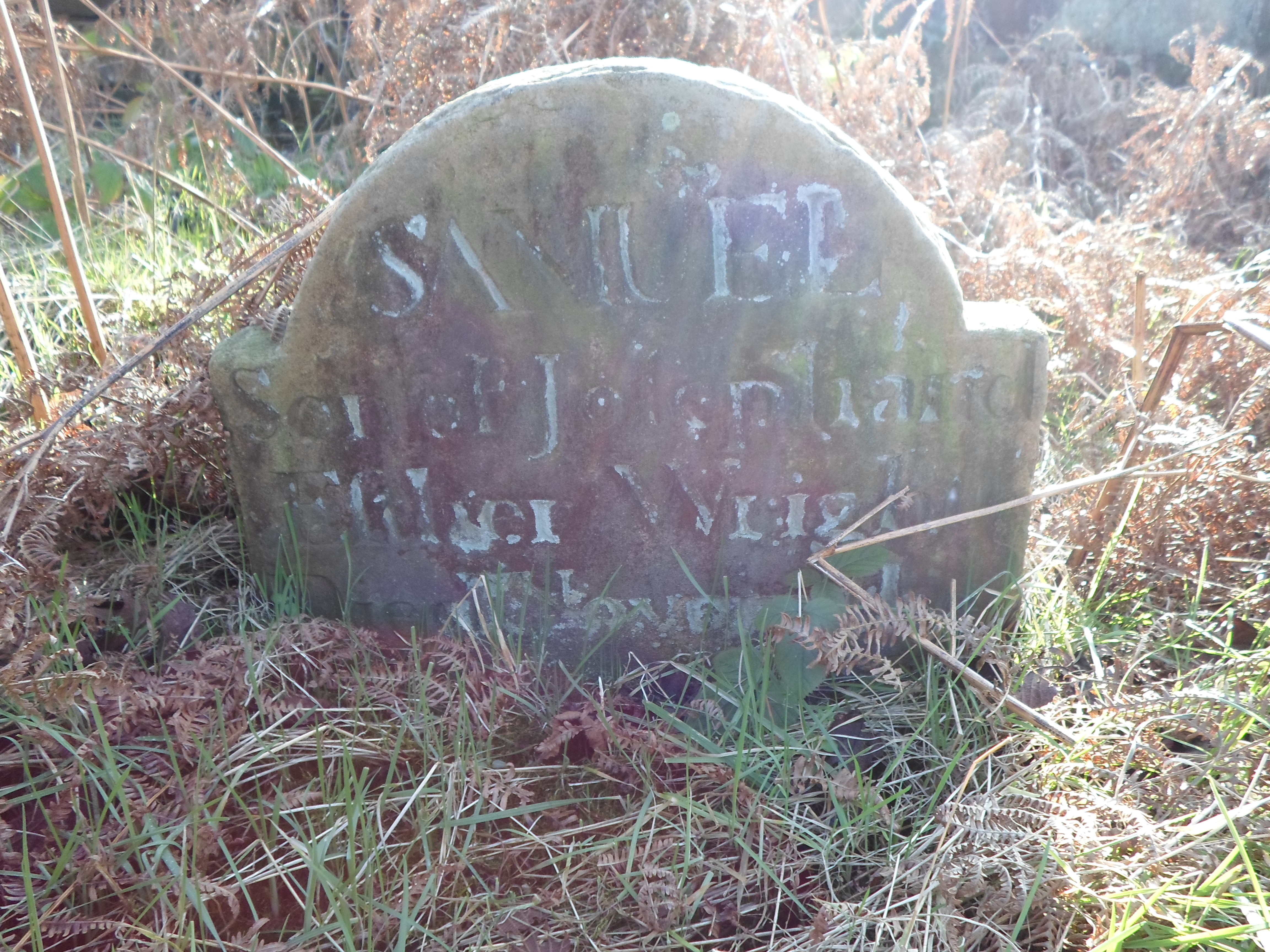
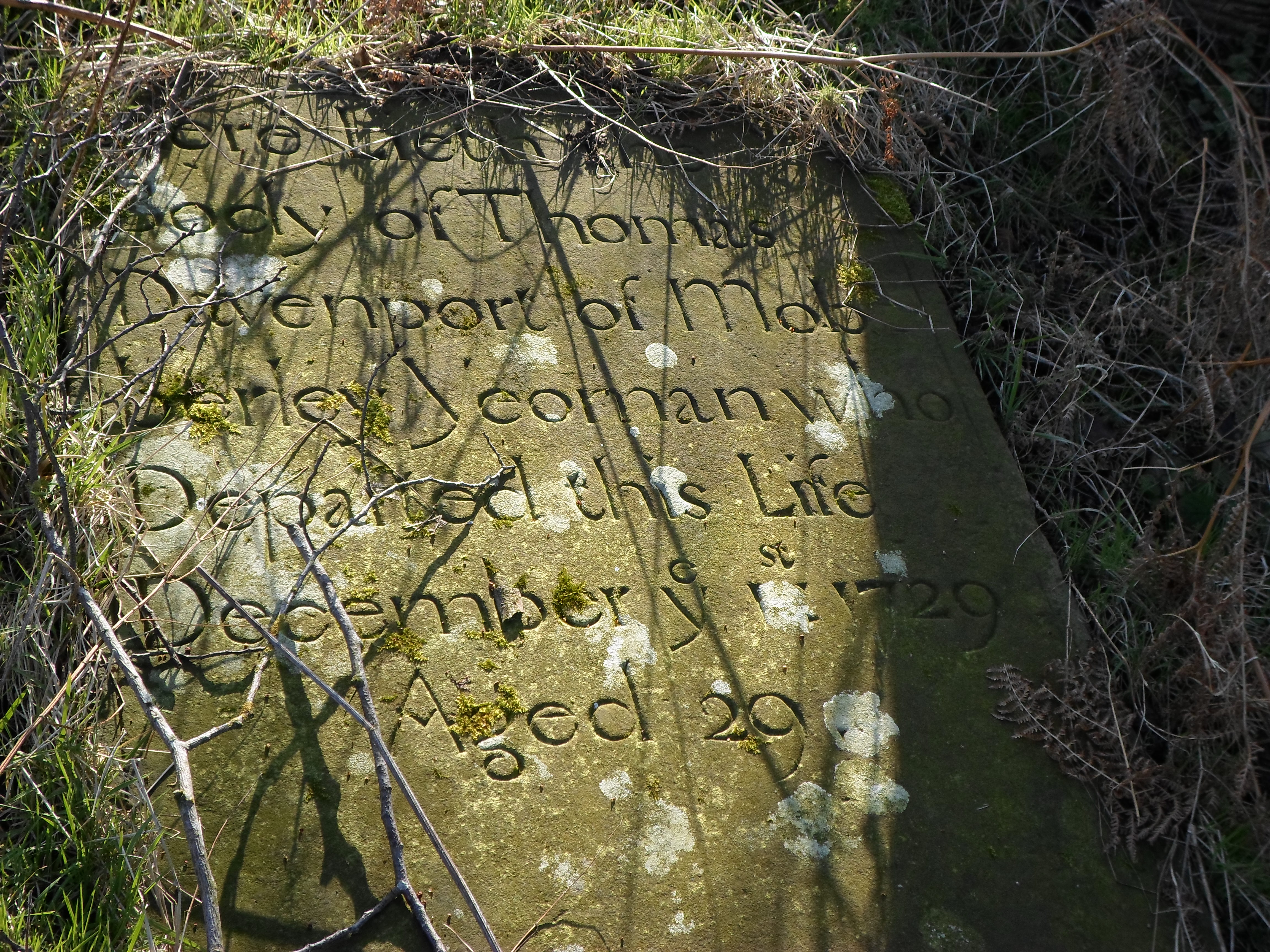
The field becomes easily overgrown with bracken and most of the gravestones are now obscured, but some beautiful examples remain.
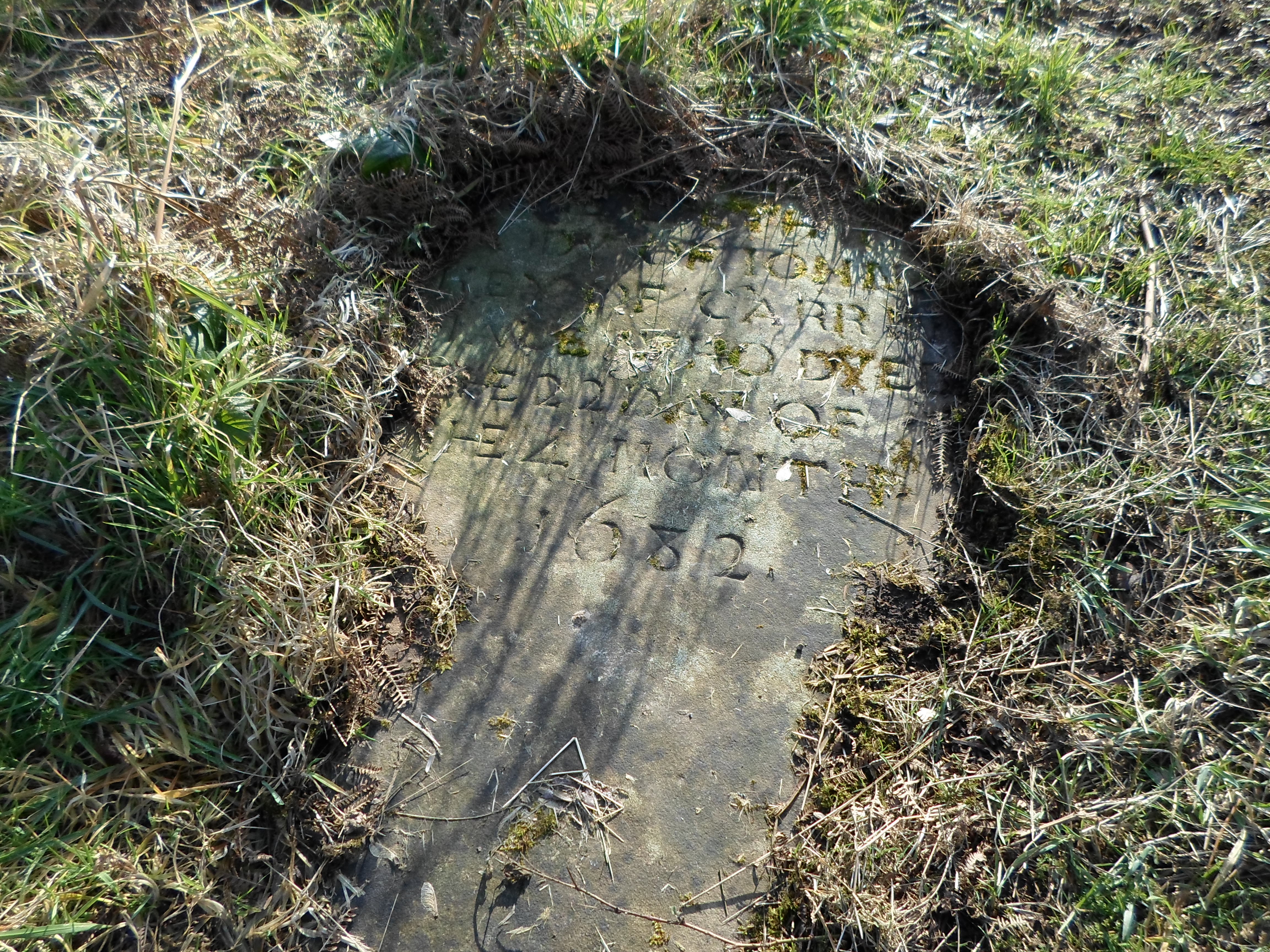
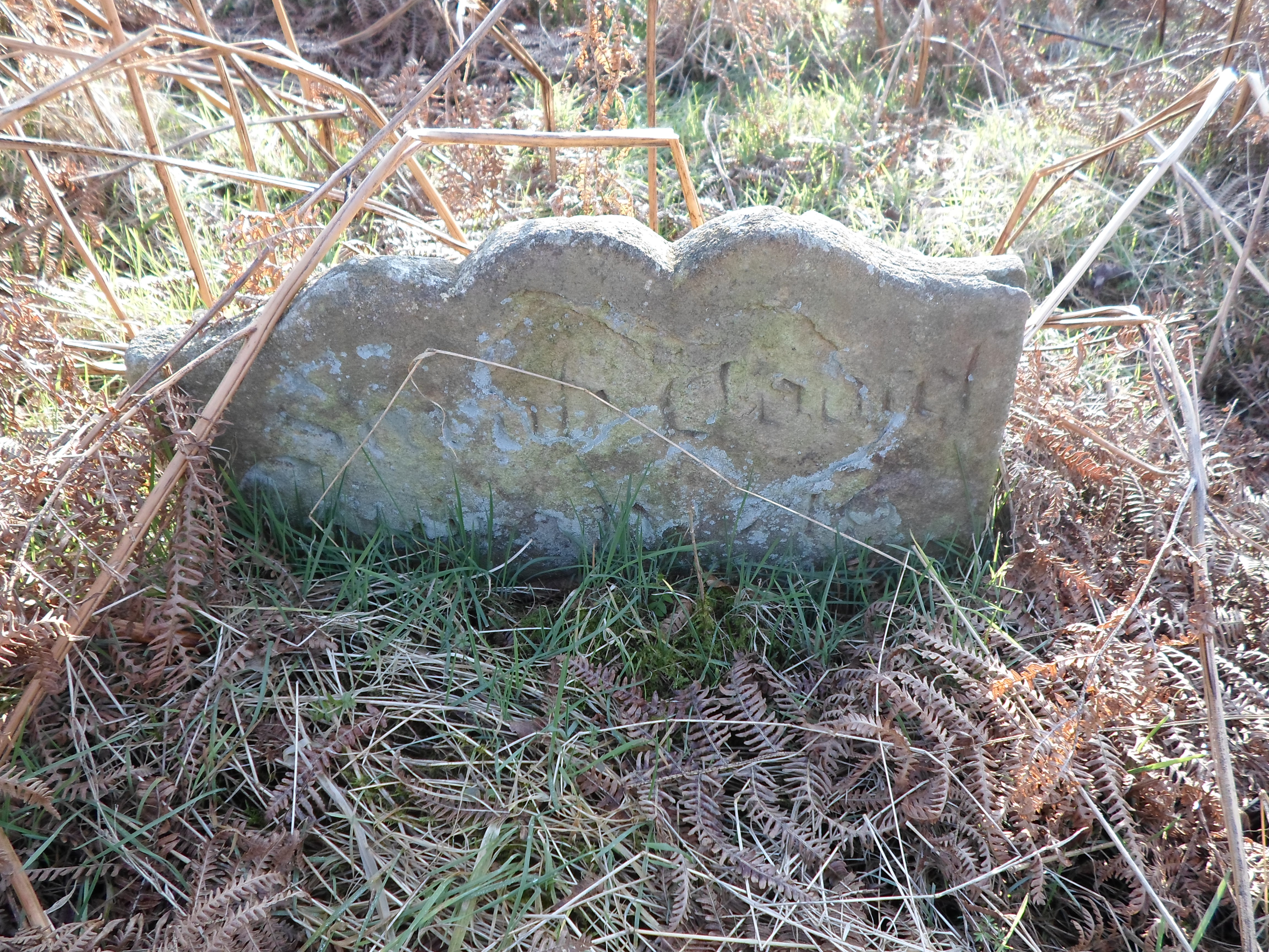
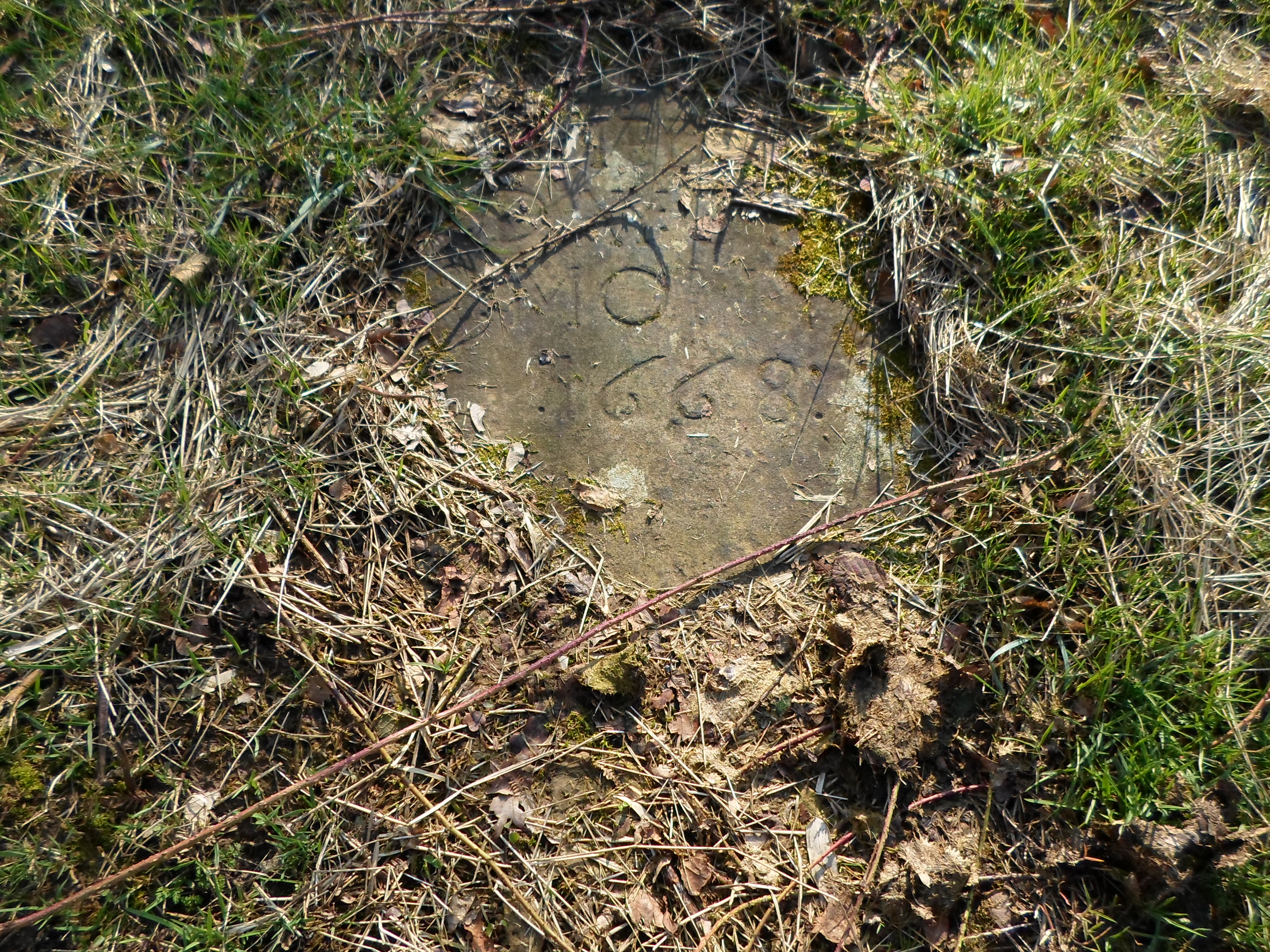
The local historian Mr Alan Dale, spend many hours researching the official registers and recorded almost 400 burials which took place here between 1650 and 1750 alone.
After the Act of Toleration was passed in 1689, Quakers were allowed to worship on their own terms, and were able to establish a local meeting house on the main Altrincham Road at Morley.
The nearest meeting house is now sited on Bourne Street in Wilmslow, and the congregation continues to flourish.
What a visit to the Quaker Graveyard can do for your spiritual and emotional well-being, will only be known by you, if you visit.
I, for one, found it to be a peaceful and idyllic sanctuary, some where to think and reflect, and a reminder to us how the people buried here held on to their religious beliefs, in the face of much adversity.
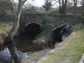
Secrets of Ingersley Vale
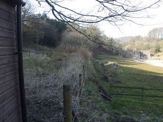
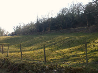
Ingersley Vale lies on the River Dean between Bollington and Rainow. By car, it is only accessible from Bollington, though most of it lies within Rainow Parish. A walk on foot, however, is rewarded with stunning views, waterfalls and a chance to see industrial archaeology indelibly marked on the landscape.
Starting out on Sugar Lane and heading towards Bollington, the path leads through Hough Hole Farm, and skirts round a reservoir, to the site of Hough Hole Mill. Demolished in the 1940’s, this was originally built in 1803 as a cotton spinning mill. The building was painted white, which prompted the local nickname, “The White Shop” which managed to make it on to some maps.
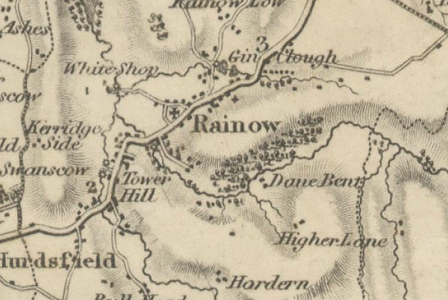
Extract from Christopher Greenwood’s Map of 1819
With thanks to Cheshire Local History Association
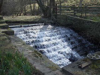
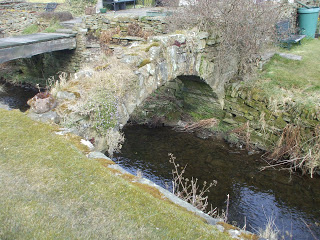
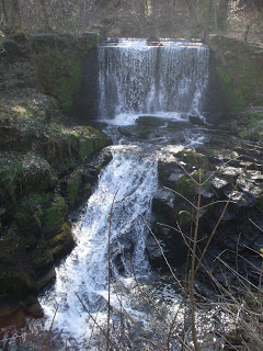
Weir connecting the reservoir and the River Dean
The current bridge over the river replaced a much older one, which is now a picturesque ruin.
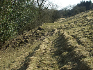
Climbing the hill and walking along below the Saddle of Kerridge, plenty of evidence can be seen of the areas coal mining past,scarring where extraction has taken place, and evidence of access tracks, zigzagging across the hillside. The coal would have been mined by means of simple bell pits, as some outcrops are close to the surface.
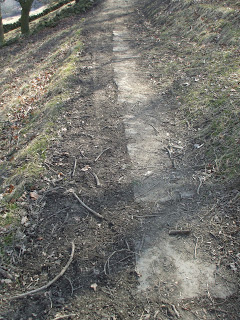
Descending into Waulkmill Wood, the path is lined with huge slabs of Kerridge Stone.
Waulkmill Farm takes it’s name from the Waulk/Walk or Fulling Mill which is marked on the earliest known Rainow map, and was tenanted in 1611 by Rauf Thorley. The term ‘fulling’ refers to a process in woollen clothmaking, where the cloth is cleaned and strengthened by matting the fibres together.
Here the river level drops quite dramatically over another weir and rocky ledge.
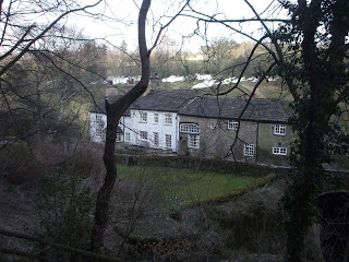
Waulkmill Farm
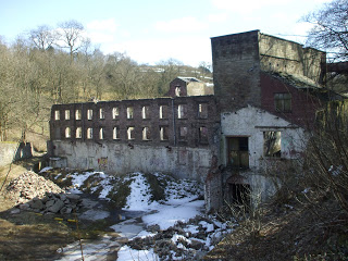
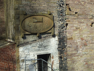
Pressing on towards Bollington, you cannot miss the massive crumbling remains of Ingersley Vale Mill. Built around 1803, by Edward Collier as a cotton spinning mill, it probably replaced an earlier structure. It appears that later extensions and additions were made in 1809.
Water would be brought to the mill from Clough Pool above Waulkmill Farm along a hill side leat, over the road and into the wheelhouse, shown on the left of the fence below.
The stone wall shows the direction of the old mill leat
This turned two water wheels in the mill, one above the other, the upper wheel 22 ft in diameter, the lower, 32ft.
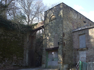
The Wheelhouse
After it’s use as a cotton spinning mill, the building was later used as the premises for a calico printers, in the 1840’s and in 1874, the building is listed as being occupied by Anthony Scott and Co. dyers and yarn polishers. By 1878, the King family moved in and the building was used until 1929, as a Bleaching and Finishing works.
For more information about the places mentioned here and others on and around Kerridge Ridge, the The Kerridge Ridge and Ingersley Vale Countryside and Heritage Project have put together an excellent Historical Study, with detailed notes on farms, mills and other industries which have shaped the area.
| . |
Scenery or Landscape?
The term ‘landscape’ according to the OED was first used by Dutch painters in 1598 to describe pictoral representations of natural scenes on land. It came from the original Dutch landschap which simply meant, an area of land. It was initially translated as landskip:
‘In a table donne by Cæsar Sestius where hee had painted Landskipes.’
R. Haydocke tr. G. P. Lomazzo Tracte Artes Paintinge iii. i. 94 1598
It was not until the early 1700’s that the term as we know it today came into use to describe a view of physical topography.
‘Thus we coasted the shore, fully employed in the contemplation of this diversified landskip.’
B. Robins & R. Walter Voy. round World by Ansonii. i. 111 1748
Another definition of ‘landscape’ can describe it as a region which has distinguishing characteristics or features, regions which Cheshire has in abundance. For example, the mid Cheshire Sandstone Ridge, the distinct moorland upland areas east of Macclesfield and the low lying salt flats of the Dee Estuary, to name a few.
The OED also notes that landscape has also come to mean a description of something in words:
‘To compare the Natural Face of the Country with the Landskips that the Poets have given us of it.‘
1705 J. Addison Remarks Italy Pref. sig. A4v,
‘the Cheshire Plains as a garden; Spread in peace beside the winding silvery river; Stretch’d right onto sea or soft blue hills in the distance’
Taken from ‘Edith or Love and Life in Cheshire‘ by Thomas Ashe published in 1873
How then does landscape differ to scenery?
For me, scenery is exactly that, a background, a scene, a view, against which events happen.
A landscape, however, is three dimensional; it surrounds us 360 degrees and we can interact with it, and it with us. It is made up of layers, layers of time, and layers of events, which need to teased out for us to fully understand what we see before us.